I’ve been talking a lot
about this layout but never really presented a comprehensive understanding of
the area. Quebec City never was an important rail hub but rather a secondary
terminal. For this reason, I don’t expect railfans across the nation and
worldwide to know it. Nowadays, rail transportation is rather minimal here
compared to what it used to be. But truth to be told, there’s still a lot of
action, mainly in handling of bulk commodities like grain, alumine, coal, jet
fuel, fertilizer, salt and others. Quebec City is also home of Canam-Structal
plant shipping many steel bridges and building structures by rail all over
North America.
On the map, most important
railway related features of the city are presented. Also, some well-known
landmarks as Château Frontenac, Palace Station (terminal of VIA Rail Corridor)
and Plains of Abraham where Canada’s fate was decided in 1759. CNR tracks are orange,
CPR tracks are red and abandoned tracks are blue.
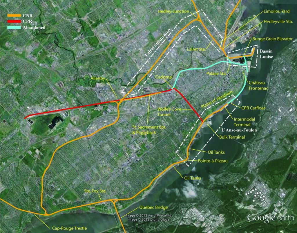
Three areas inspired our
layout, namely “Lairet Subdivision” located in Limoilou Ward, “Bassin Louise”
which is Quebec City old harbour and “L’Anse-au-Foulon” (Wolfe’s Cove) which is
a bulk terminal.
Our layout isn’t an exact
reproduction of these areas, but still faithful enough for someone to recognize
clearly them in HO scale.
No comments:
Post a Comment